-
 Σύνδεση | Εγγραφή

Συνδεθείτε στο λογαριασμό σας
Συμπληρώστε το e-mail σας για να επαναφέρετε τον κωδικό πρόσβασης.
29 & 30 Απριλίου 2025, 5:30 μ.μ.
Σπάνια Βιβλία, Χειρόγραφα, Έγγραφα & Χαρακτικά
LOT 332
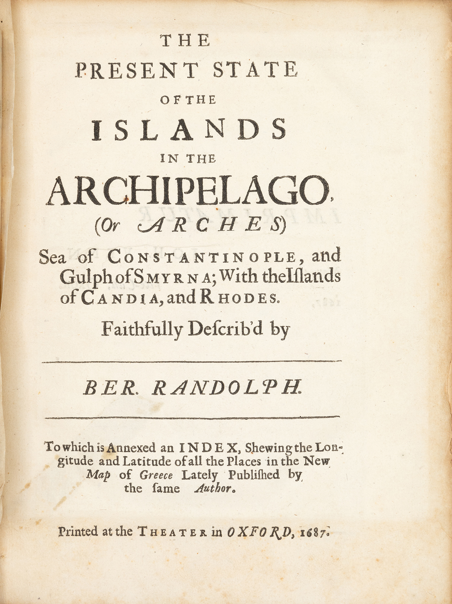
RANDOLPH, Bernard.
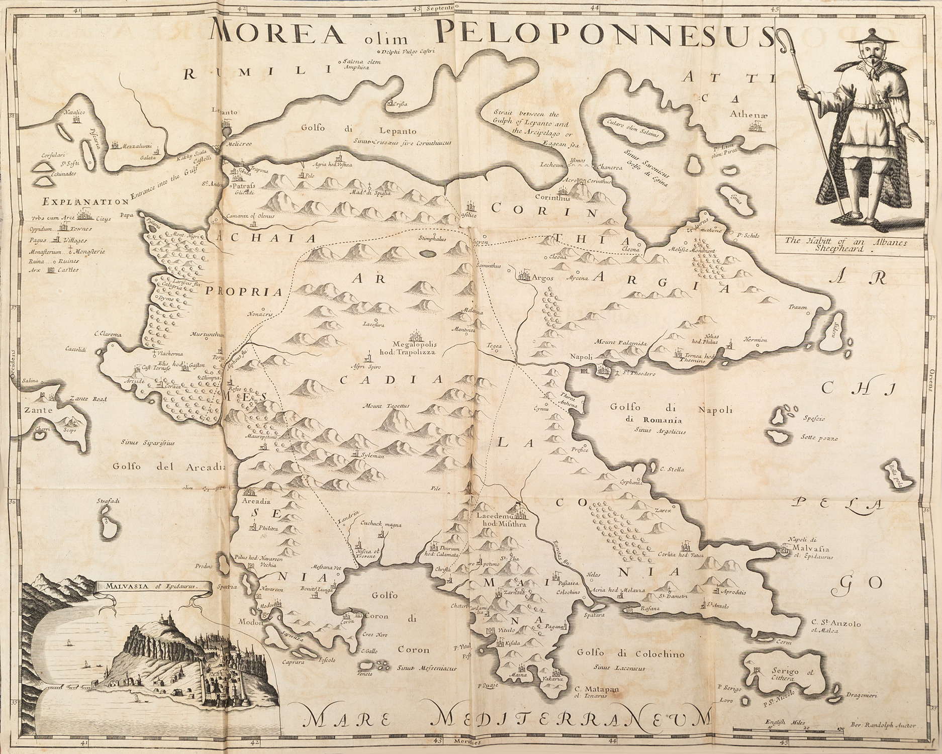
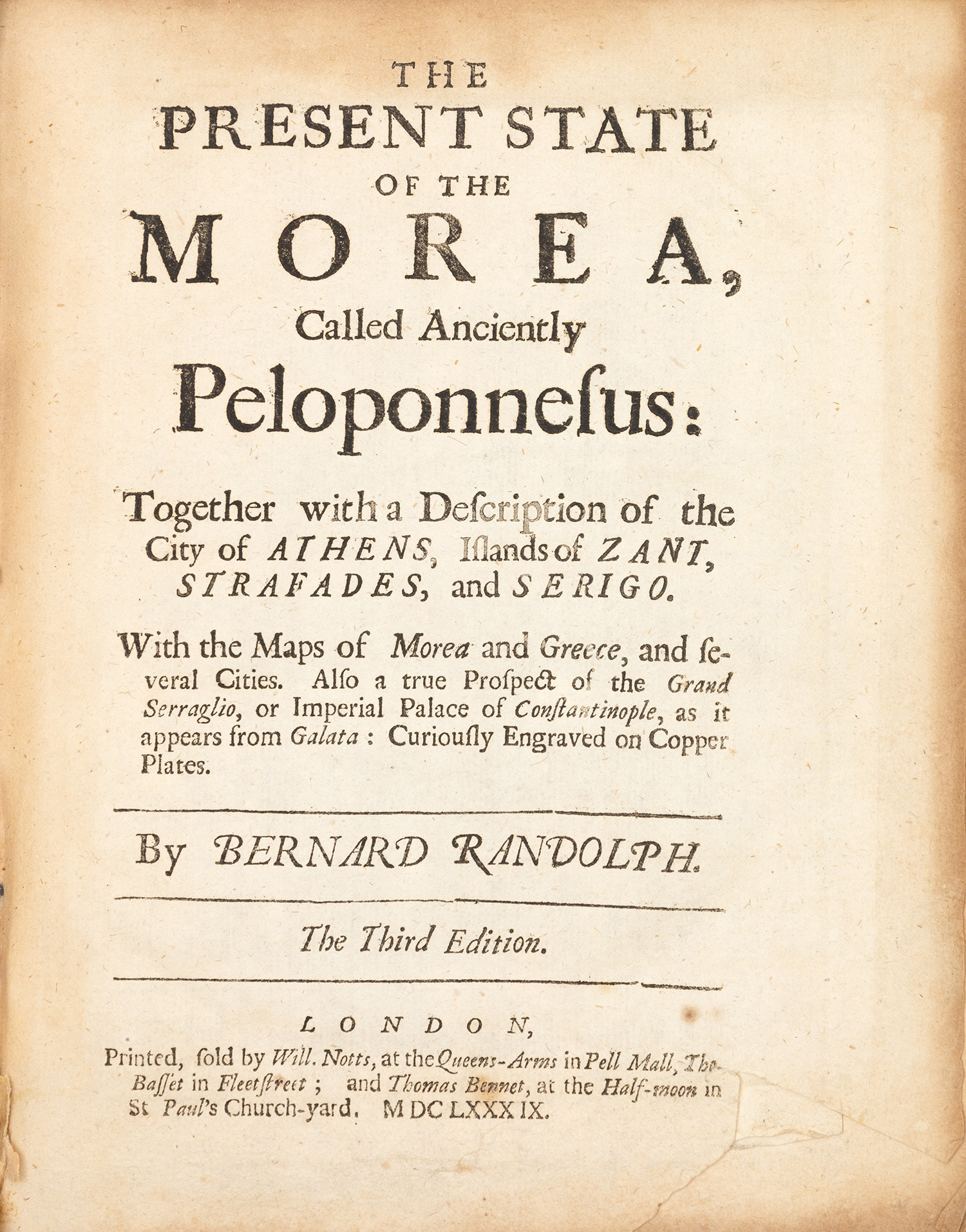
The present state of the Morea, called anciently Peloponnesus: together with a description of the City of Athens, Islands of Zant, Strafades and Serigo. The third edition.
Τιμή εκτίμησης: € 3.000 - 4.000Πληροφορίες
μικρό 4ο, 209 x 160 mm., 26 σ. (λείπει μικρό τμήμα από την κάτω δεξιά γωνία του τίτλου, ομοιόμορφα οξειδωμένο αντίτυπο, μικρά σχισίματα στον ένα χάρτη, ένα μεγαλύτερο στον άλλο, μία χαλκογραφία δεμένη μαζί με το άλλο έργο). Με 2 αναδιπλούμενους χαλκόγραφους χάρτες («Morea, olim Peloponnesus» και η δεύτερη από τις τρεις μορφές του «Greece with part of Anatolia») και 3 αναδιπλούμενες χαλκογραφίες ([Κόρινθος], «Misithra, olim Lacedimon» και «The Prospect of the Grand Serraglio»). Δέρμα της εποχής της έκδοσης (φθορές). Blackmer 1385, Atabey 1012, Weber, II, 388, Zacharakis 2882. [δεμένο μαζί, του ιδίου:] The present state of the Islands in the Archipelago, (or Arches), Sea of Constantinople, and Gulph of Smyrna; with the Islands of Candia, and Rhodes. To which is annexed an Index, shewing the Longitude and Latitude of all the places in the new Map of Greece lately published by the same author. Οξφόρδη, J. Venn, 1687. • μικρό 4o, 108 σ. (ελαφρά οξειδωμένα λίγα φύλλα, σχίσιμο και σημάδι από σελοτέιπ σε έναν πίνακα). Με 3 αναδιπλούμενες χαλκογραφίες («Negroponte», «A Greek priest / A woman of the Archipelago» και «Tenedos»). Blackmer 1386, Atabey 1013, Weber, II, 389, Contominas 601.
Χαρακτηριστικά
- Συγγραφέας: RANDOLPH, Bernard.
- Τίτλος: The present state of the Morea, called anciently Peloponnesus: together with a description of the City of Athens, Islands of Zant, Strafades and Serigo. The third edition.
- Στοιχεία έκδοσης: Λονδίνο, W. Notts, T. Basset & T. Bennet, 1689.